Wednesday, May 30, 2018

Convict Lake | Crowley Lake | BLM | California


This was my first glimpse of Convict Lake in California.  Supposedly, the name was given to this lake when convicts were found hiding in the area.


Unfortunately, the weather was not cooperating and giving me blue skies for my photos, but I like this one.

 
This is where the lake runs downstream when the snow melts.
 
 
The Crowley Lake BLM Campground nearby is great - lots of spaces between the sites.  There weren't many people there, but it was rainy and windy every afternoon for the week I was there.  Mornings were best to get blue skies!  This campground had not only the vault toilets, but drinking water and a dump station.


On the road headed to the campground from the Lake, I came across this interesting house, which used to be a ranch, now abandoned.


Along Route 395 in California, you see many abandoned houses, and this one had space for me to park my truck and explore.


While I was taking photos around the outside, a woman stopped her truck and got out, heading toward the house.  I asked her if it was alright for me to take my photos.  There were no signs to keep out, so I figured I was OK.  She was the realtor and said I was fine - we started talking and she walked inside, so I followed.  Apparently she had a buyer who might be interested.  I can't imagine taking on a project this bad, but the shell was in great shape.


Sunday, May 27, 2018

Goodale Creek Campground | BLM | California


This was a very scenic campground, snow dusting all the mountains.  Another nice BLM campground, but at least when I was there, not many campers. 


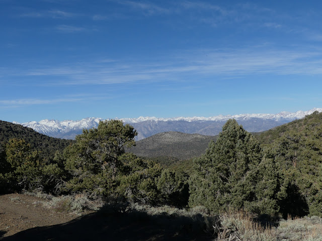
Snow was all over the mountain peaks, but down at land level, things were in bloom.


We had some windy days, but not too bad, so things were comfortable.  And the scenery was great.

 
Don't know if this was for a pet or what - but it was behind one of the campsites.
 

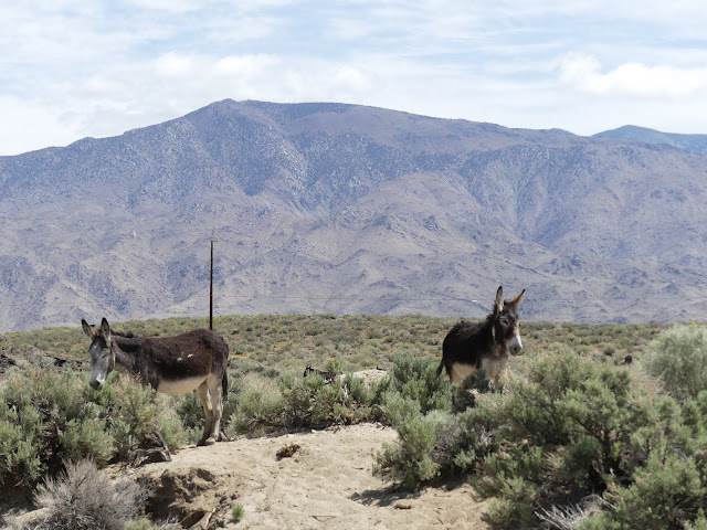
These little burros were hanging out on the road near the campground.


The town of Independence is nearby, but not very big.  It has a few impressive buildings like this old hotel which is now a B & B.


This was for sale, and looked very nice.

 
You'd think the town was massive, with this huge court house, but it's the county seat.
 

I took a drive up to the Ancient Bristlecone National Monument, but at 8,000 I was starting to get a bit of a headache because of the elevation. 

 
The scenery was great.


Gigantic trees - I think this is a Juniper.


I have never seen a lizard that was totally black and this one didn't really want to pose.


And a winding road all the way down.


Tuesday, May 22, 2018

Tuttle Creek Camp | BLM | Alabama Hills | California


Tuttle Creek is a BLM (Bureau of Land Management) campground about 5 miles from Lone Pine on Route 395 in California.  It's a nice campground, but the spots are not very spacious and the two I tried needed quite a bit of leveling - not a problem if you have automatic leveling.  This was my campsite for a while. 

The campground has a small creek running through it and some people were catching trout.  It's a nice little creek and I went down to take a few photos.


I took a drive up the mountain where there are campsites at 8,000 feet.  It was a steep drive on a curving narrow road perched on the side of the mountain.  I was treated to scenes of tall pine trees and the snow covered peaks.  I could not imagine towing anything up that road but I did look down at one of the campsites and saw a trailer.  Impressive!  I was happy to be safely at the bottom, after a slow trip down.  There were many areas where the road did not have any type of guardrails.
 

Great scenery!


Check out the curvy road on the right in this photo.  And this was one of the straighter areas!


This is looking down from about halfway from the top of the mountain road.

 
Alabama Hills is nearby and there were conflicting reports of boondocking allowed - or not.  There were quite a few rigs scattered around the area and there were no reports of anyone being told to leave, so as of May, boondocking was allowed.  The brochure for this area states that dispersed camping is allowed for 14 days. 
 
It is said that the prospectors who mined here named the area after a Confederate warship of the same name.
 
This is the first thing you see on the way to the campground, or entering the Alabama Hills area.  I'm not sure if he is just graffiti or someone dressed him up for a movie.  In any case, he gets lots of attention and photos.
 

This is a large area of dramatic boulders.  I only saw a small portion of the area, it keeps going for miles.  The area is famous for movies - back when The Lone Ranger and Hopalong Cassidy were in the area.  There were movies filmed during the 1990s in the area also, including Star Trek Generations.

There is a famous arch that I wanted to get some photos of, so I set out on the trail.  There weren't any signs, so I saw a small arch and went over to photograph it.  Not the one I was looking for, but it made an interesting photo.  I had to crawl up and sit on the rocks to get low enough to get the mountains in the shot.  I kept thinking that it certainly didn't look like any photographs of the arch I was searching for.   

 
Only a few minutes later, I came across the Mobius arch, the one I had set out to find.  Much easier to photograph, although I like the photos of both of them. 


These are different angles of the same arch.

 
There were some great views and the rest of these photos are shots of different areas I saw.  There were also rock climbers in the area.


Thursday, May 17, 2018

Manzanar War Relocation Center | California


Japanese people started to immigrate to the United States back as far as 1882 because they felt they could make a better living.  They became citizens and started businesses, not knowing what was in store for them and their descendents in a few decades. 


When World War II started, the government decided that Japanese citizens (and, of course, all who were not citizens) should be gathered together for the safety of the rest of the country.  The facility on Route 395 in California was named Manzanar.  The Japanese citizens were taken by bus to one of the 10 "relocation centers" that had been built specifically for this purpose.  They were allowed to take only what they could carry.  The ones who had businesses tried to sell them, but many were abandoned. 

They were told that the government was protecting them - but the guards organizing the bus transportation had guns with bayonets.  When they got to Manzanar, it was enclosed with barbed wire with a guard tower.


There were rows of barracks for them to inhabit, their beds were bags filled with straw.  There were 36 blocks of barracks that held the 10,000 people who resided at Manzanar.  There were too many people to have any privacy.  Windstorms made life difficult, as well as sweltering sun in the desert in the summer.  The photo above shows how close the barracks were.

 
There were multiple in the rooms, some hung cloth up to provide minimal privacy.
 

Bathrooms were built with sinks as shown below, as well as toilets and a shower room.


Most of the buildings are gone now, with just concrete slabs marking the locations.  The Federal government had made an agreement to remove the buildings to restore the land.  The buildings were sold at $330 each, or were deconstructed.  Some of the buildings were moved to other towns to become motel rooms or private homes, in one instance.  Now there are only a few buildings.

 
There was school for the children.  A non-Japanese woman volunteered to come teach them since she thought the entire situation was wrong.


There was a mess hall and the staff put in long days to feed everyone, although the food was not that appetizing and not what they were used to. 


\
They had a ball field for games, as well as a band so they could have dances in the mess hall.  They made a rock garden with running water, a soothing place to sit and relax.  There was a fish pond, a farm and garden and a chicken ranch, as well as a hospital with staff.  I'm sure that some of the residents worked in those areas. 


There is a cemetery monument with a few graves and this memorial.


This is at the cemetery site - colorful folded paper, origami.


There was also a factory to produce woven camouflage nets for the Army.  There was some discontent among the workers, sparking a riot and soon the factory closed.  There was a mattress factory near the weaving shop, but unfortunately it burned in 1943.  By 1944, there were other goods produced there by the residents including clothing and furniture, as well as agriculture.  At that point, they were pretty much self-sufficient.  All those buildings are gone also.


At the end of the war, they were given $25 and a ticket.  From 1990 to 1999 the government sent an apology letter, along with $20,000 to the inhabitants of all of the 10 camps, 82,000 people. I don't remember any of this in my history classes, I wonder if anyone else remembers anything about this.