Showing posts with label national park. Show all posts

Tuesday, May 14, 2019

Saguaro National Park | Tucson | Arizona


At the top of Gates Pass in Tucson is a place to pull over and get some scenery shots of the surrounding area.  There are some ruins in this area, including the one above.


Contrary to what most people would think of a desert - there are times when it's quite colorful.  All the yellow trees are called Palo Verde.

 
Palo Verde trees bloom yellow in the spring, and then will turn green.  The trunks of the trees are also green, and the name means Green Sticks.   Unfortunately, with the partly overcast day, this one doesn't look as vibrantly colored as they are.
 
 
Cactus!  Really pretty and colorful when blooming - just don't get too close!


Usually a cactus will have a single color in one plant.   There were multiple ones of this type with two different colors blooming together.


Cholla, the cactus below has a nickname - the "jumping cactus".  Definitely stay extra far from them - you can imagine where they got their nickname!  They have caught me and I knew I wasn't that close!  This one is a small one.
 

The Saguaros usually look similar to this and some have many more arms on them. 

 
Some of them get tired, and their arms sag.  Technically, I have no idea why they do this, but it may just be a problem of getting older.
 

These cacti grow slowly, and may be 70 years old before sprouting branches on them.  By the time they are 150 years old, they can reach 50 feet, some of them, even taller.  Since they collect water, the bigger ones can weigh tons.

 
Saguaro cactus is home to many birds.  They drill into the cactus to make a little den for a nest.  Some birds will use abandoned spaces from previous years and build new nests.  This was taken at a different location, since I couldn't get a good shot that day.
 
 
This photo is an ocotillo, and it's not a dead plant, although it looks a bit sad.  This is what it looks like when there has been no rain.  You'll see in the following photo this (at another location) another ocotillo has had enough rain to keep leaves on the branches.   You can see a few flowers at the tips of the branches, even though it hasn't had rain recently.  When it does rain, it takes only a few days for the ocotillo to sprout lots of green leaves.
 
 
This is an ocotillo near where I'm staying and it has been full of greenery and blooms for weeks.  It's an interesting plant - just multiple stalks from the roots - with lots of thorns along the entire branches.
 
 
This might be cheating a little, but this cactus was near where I was staying, I just thought I'd add this because it's so pretty. 
 

Arizona has lots of nice sunsets.

Wednesday, March 16, 2016

Balcony House - Mesa Verde National Park


I have heard of Mesa Verde from everyone - a must see, do-not-miss type of warning. And they were right - it's an amazing National Park. It has been on my list since before I set out.

When I got to the Durango area, I found the campground where two of my fellow solo female RVer were staying. We have been meeting up off and on when our paths cross. It just so happened that the day I got there was their last day at that camp.  When I arrived that morning, they invited me to go to Mesa Verde for the day. Sure - sounded good to me!


The park covers a large territory and the roads wind up and down the mountainsides. We had time to do only one tour - Balcony House. At the appointed time, there were about 20 or so people gathered for the tour. After a short briefing, we started down into the canyon by a series of steel stairways. The trail was only a quarter of a mile long, but during that time, we climbed a 32' double ladder to the first rooms. This photo of the ladder was taken after everyone had safely arrived at the top.


The next area was visible through a window between the two living areas.

 
After a briefing about the first area and the construction, the next area was accessed by a skinny tunnel......


The next area contained two kivas, areas that had multiple purposes in the puebloan peoples' lives - ceremonies and socializing. Kivas are always round and sunken. When they were in use, they had ceilings.


During their construction of all these cliff dwellings, they used the existing rock formations and caves as part of their construction, as seen below.


This was the final area of this little neighborhood and we had to exit through a tunnel. This tunnel was so small, we all had to crawl through it, only a few feet until we could stand and then another crawl area for a few feet.


After that, the fun continues, there were steep steps carved into a rock heading up the hill. These had been carved over 800 years ago. They are so steep that, to prevent mishaps, the park has installed heavy chain railings and a safety net on the downhill side.


After a couple of short ladders, the tour was over. Such a great place, such an experience to see how these people lived more than 800 years ago. For some reason, they moved out in 1200 - no one seems to know why.


I will be back to do more of their tours of the cliff dwellings and to further explore the park. There is much more to see here.


Thursday, September 3, 2015

Arches National Park - Part 2


For the next trip to Arches, I picked a nice sunny day - love the blue sky in my photos. It may have been hotter to hike, but I like the pictures better.

 
Not everything in this park is arches, as you can see by the balanced rock below. This one stands 128' tall, and there used to be a smaller balanced rock, but it tumbled down.
 
 
The broken arch has a very small crack at the top, which means it is subject to weather and erosion.


The Landscape Arch is very thin and if you look at the left side, you'll see a long horizontal crack in it. In 1991, there were other cracks like this and the weather finally chipped away a few parts of it. Before that happened, the trail went under the arch - but since it's so fragile, no one is allowed under it anymore.
 
 
This next rock formation is called "The Gossips" because it looks like people gathered together telling stories.
 
 
Just a few extra shots I like.....


Wednesday, September 2, 2015

Arches National Park, Utah - Part 1

 
This park is so big I had to spend the better part of two days to see most of what I wanted to see.  It's the hiking part that slows me down, you can drive through it all in less than a day but you don't get to see everything.  The photo above shows me under the Delicate Arch, an hour's hike mostly uphill on sandy trails and slick rock. Slick rock isn't really slick, it's rock covering a massive area that's been shaped almost smooth by wind and weather. It's usually good to hike on as long as you've got hiking boots with good traction, since it's not really slippery. The first day I was there, it was totally overcast the entire day, great for hiking and keeping cool - but not great for pictures.
 
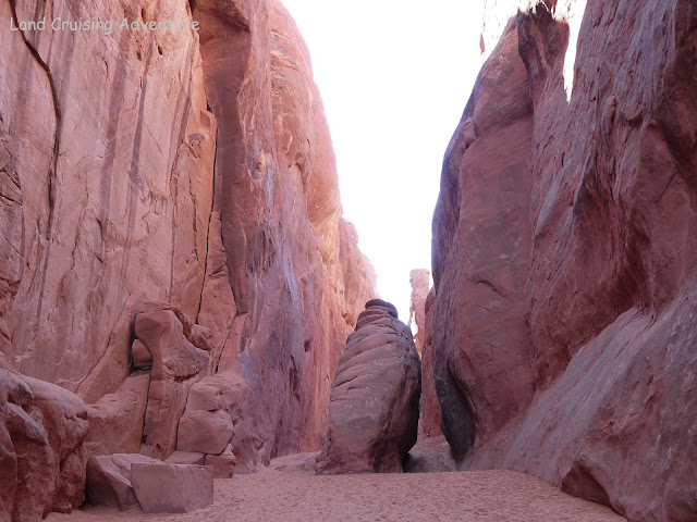
This area is full of gigantic red rock formations shaped by changing geological conditions and weather for millions of years. The scenery here is spectacular, within a few short miles you are surrounded by these rock formations and then you'll come across a valley area with mesas at the horizon.  This arch is the iconic one shown on license plates and other advertising for the area.


I hiked to several other arches that day, most of the other hikes weren't as strenuous or as long. 


Monday, July 27, 2015

Mesa Verde - Long House


Doesn't look like a good day for a hike. About 25 people waited for the Park Ranger to start his briefing on the tour on which he was going to take us. He said he didn't know what the weather was going to do, but if it rained, we would continue on the hike to the ruins. OK, my major concern was my camera, but then I noticed a machine that dispensed doggy poop bags so people can pick up after their pets. They just happened to be camera size.


We walked down a path that zigzagged down the side of the canyon. I could tell it would not be a fun trip back up at this elevation.


We climbed some ladders to get to the back of the alcove that housed the ruins. Toward the back, we found a moist, mossy green area which was water seeping into the ruins. This is where the residents got water while they were living there.


The park ranger was full of statistics and we were told that the residents lived there until almost 1300. They ranged in height from 5'2" to 5'5" and the men lived about 35 years. Women weren't so lucky, they lived until about 22 and had an average of about 8 babies - not all of them lived. They worked hard, building homes, farming, making pottery and clothing. They accessed their homes by carving toe and hand holds in the cliff walls to get up to the mesa. Everything brought back to their homes was carried on their backs down the face of the cliff.